
Back to overview

A full timeline of Sydney's transit maps, 1964-2000
1971 Department of Railways map
 The map in use by the NSW Department of Railways and later the PTC, from around 1964 to 1974.
Download as PDF
1972 Public Transport Commission map
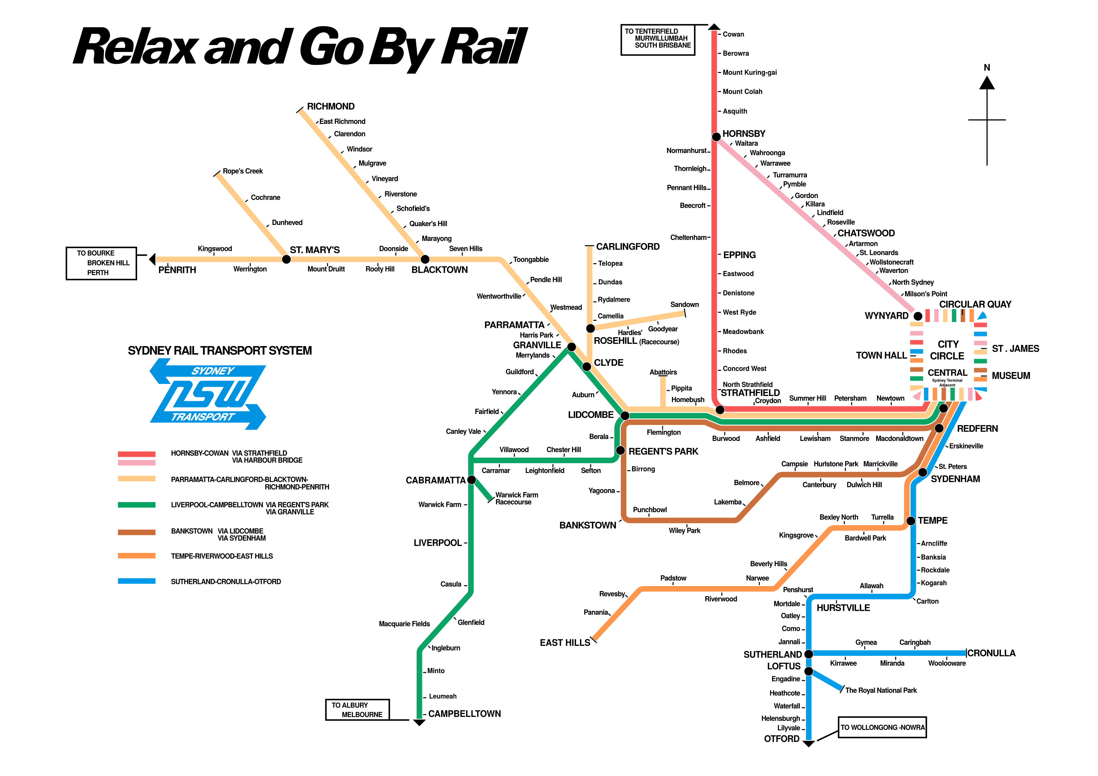 The PTC's first foray back into colour-coding their network diagram. An interesting effort that keeps much of the layout of the previous map.
Download as PDF
1974 Public Transport Commission map
 An updated version found in the Sydney Area Transportation Study, with the Eastern Suburbs Railway squeezed in.
Download as PDF
1979 Public Transport Commission map
 The PTC would first introduce a version of this design in a single colour on printed timetables in 1976, before unveiling this map in its full-colour glory alongside the Eastern Suburbs Railway in 1979.
Download as PDF
1979 Martin Place Station display
 The 1979 map also came as a beautiful dark-themed version as a lightbox display above the ticket windows of Martin Place Station.
Download as PDF
Late 1970s PTC Interurban map
 At some point in the late '70s or early '80s, the PTC released this striking map of the Interurban rail network. At the centre of the map is a fantastic stylisation of the Suburban map in use at the same time.
Download as PDF
1985 State Rail map
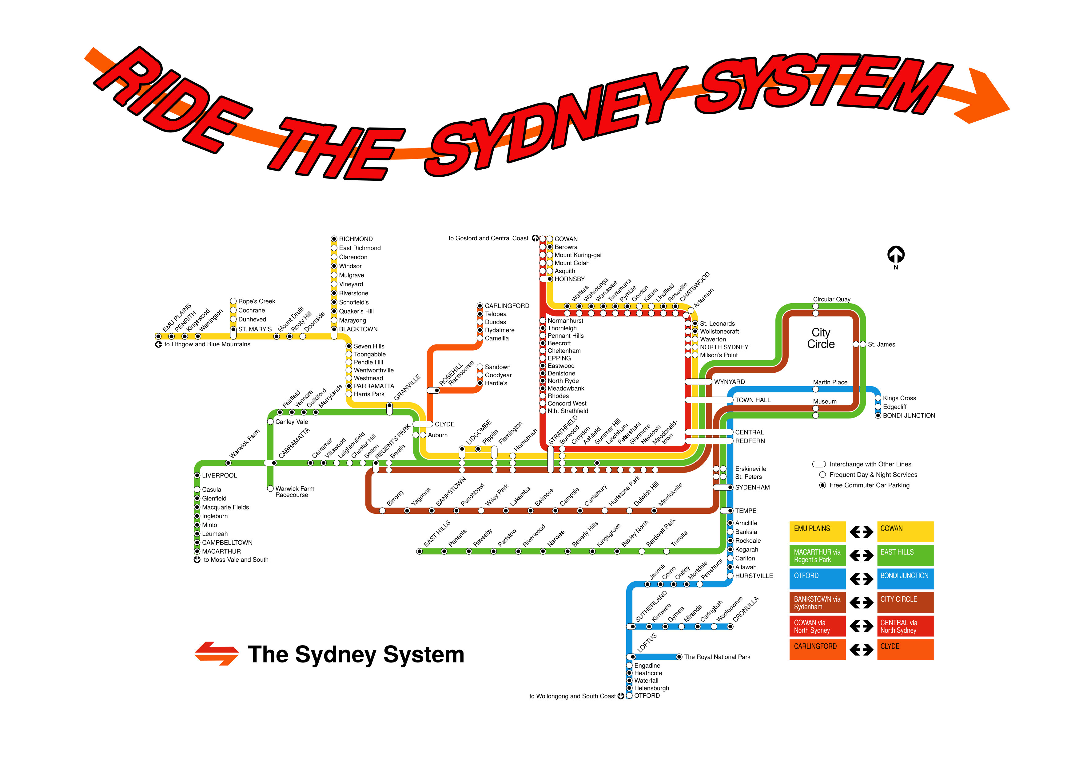
The State Rail Authority's debut map, used from 1985 to 1991.
Download as PDF
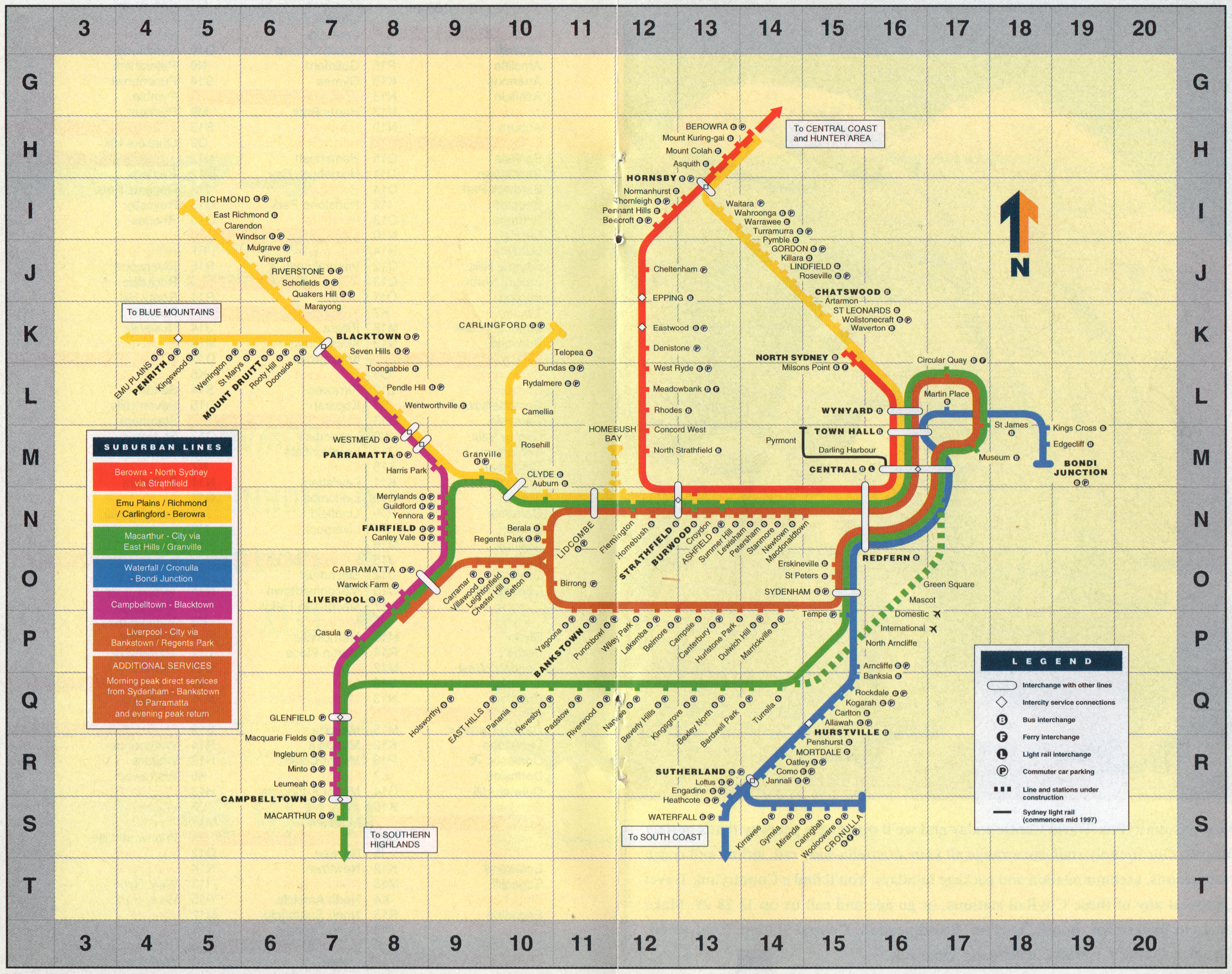
1991-1995 CityRail map
 The map introduced upon CityRail's formation in 1991.
Download as PDF
1998-2003 CityRail map
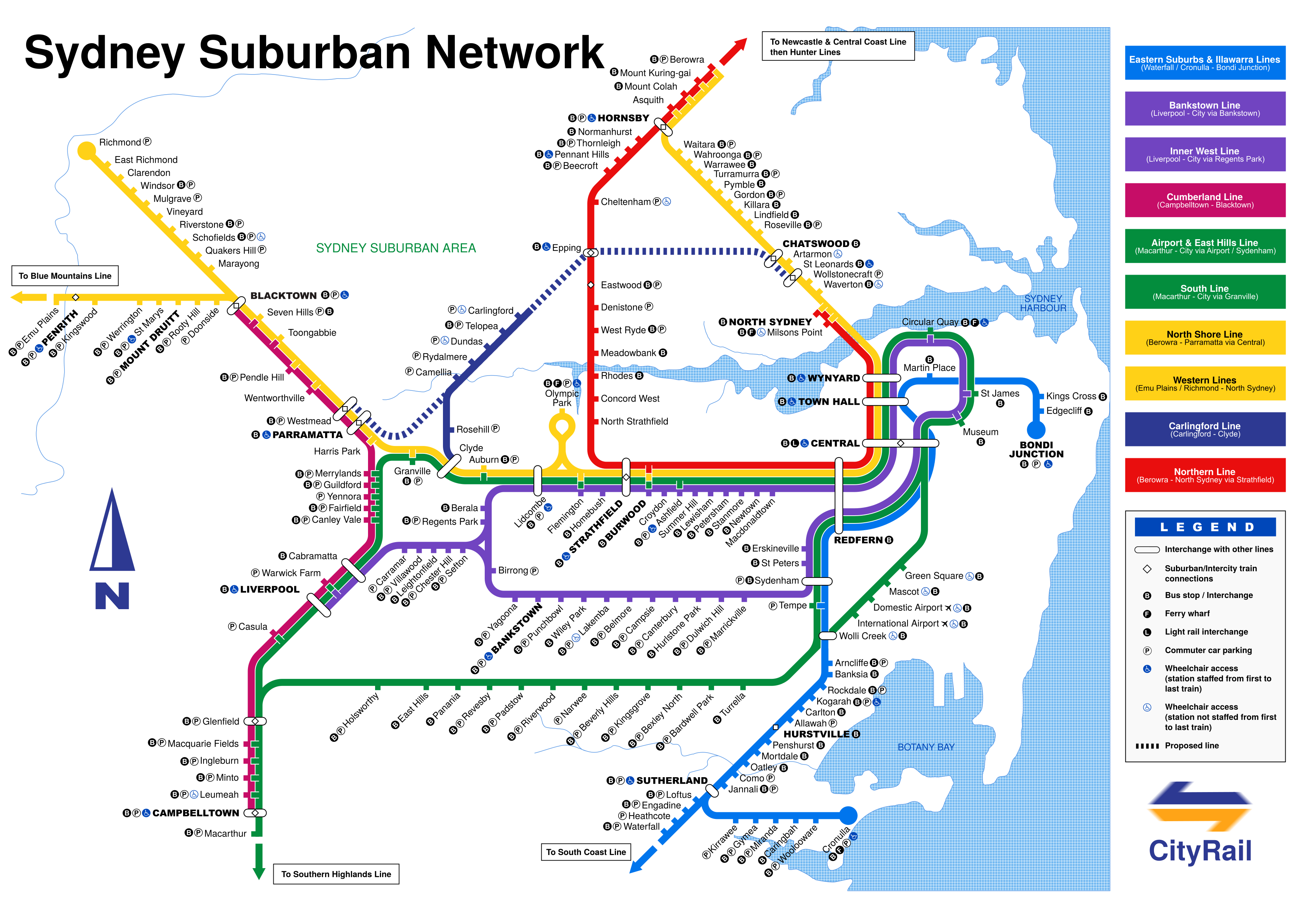 CityRail's Olympics-era map, one of the best-designed that Sydney's had. Preceded by a version with flatter terminal markers and an under-construction Airport and Olympic Park line.
Download as PDF

Crossing Lights 2026